


Voting District 5, Lincoln County, Oklahoma
About
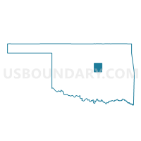
Outline

Summary
| Unique Area Identifier | 654294 |
| Name | Voting District 5 |
| County | Lincoln County |
| State | Oklahoma |
| Area (square miles) | 68.57 |
| Land Area (square miles) | 68.13 |
| Water Area (square miles) | 0.44 |
| % of Land Area | 99.35 |
| % of Water Area | 0.65 |
| Latitude of the Internal Point | 35.87283410 |
| Longtitude of the Internal Point | -96.88656650 |
Maps


Graphs
Select a template below for downloading or customizing gragh for Voting District 5, Lincoln County, Oklahoma


Neighbors
Neighoring Voting District (by Name) Neighboring Voting District on the Map
- Voting District 13, Lincoln County, OK
- Voting District 3, Lincoln County, OK
- Voting District 301, Payne County, OK
- Voting District 4, Lincoln County, OK
- Voting District 414, Payne County, OK
- Voting District 6, Lincoln County, OK
- Voting District 7, Lincoln County, OK
Top 10 Neighboring County Subdivision (by Population) Neighboring County Subdivision on the Map
- Stillwater CCD, Payne County, OK (63,113)
- Cushing CCD, Payne County, OK (11,784)
- Chandler CCD, Lincoln County, OK (8,240)
- Northeast Lincoln CCD, Lincoln County, OK (4,731)
- Northwest Lincoln CCD, Lincoln County, OK (4,140)
Top 10 Neighboring Place (by Population) Neighboring Place on the Map
Top 10 Neighboring Unified School District (by Population) Neighboring Unified School District on the Map
- Cushing Public Schools, OK (10,059)
- Perkins-Tryon Public Schools, OK (7,744)
- Chandler Public Schools, OK (6,254)
- Stroud Public Schools, OK (4,589)
- Ripley Public Schools, OK (2,559)
- Agra Public Schools, OK (1,507)
- Carney Public Schools, OK (1,244)
Top 10 Neighboring State Legislative District Lower Chamber (by Population) Neighboring State Legislative District Lower Chamber on the Map
Top 10 Neighboring State Legislative District Upper Chamber (by Population) Neighboring State Legislative District Upper Chamber on the Map
Top 10 Neighboring 111th Congressional District (by Population) Neighboring 111th Congressional District on the Map
Top 10 Neighboring Census Tract (by Population) Neighboring Census Tract on the Map
- Census Tract 111.02, Payne County, OK (6,246)
- Census Tract 9617, Lincoln County, OK (5,222)
- Census Tract 9611, Lincoln County, OK (4,731)
- Census Tract 114, Payne County, OK (4,401)
- Census Tract 9612, Lincoln County, OK (4,140)
- Census Tract 9616, Lincoln County, OK (3,018)
Top 10 Neighboring 5-Digit ZIP Code Tabulation Area (by Population) Neighboring 5-Digit ZIP Code Tabulation Area on the Map
- 74023, OK (11,741)
- 74834, OK (7,590)
- 74059, OK (5,476)
- 74079, OK (4,504)
- 74824, OK (1,253)
- 74875, OK (1,165)
- 74832, OK (936)